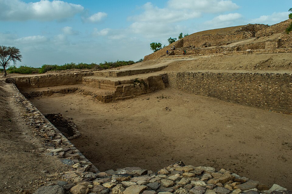
At Dholavira, an empty reservoir can explain more than a spectacular skyline. The settlement survives largely as walls, passages and changes in ground level, so its achievements become clearer when you ask an everyday question: where would the water come from? That question gives a first visit a useful direction without turning the site into a collection of impressive but disconnected measurements.
Begin with the setting
Dholavira lies on Khadir in Gujarat’s Kutch region. UNESCO describes a Harappan settlement with a fortified city, a cemetery and a carefully developed water-management system. Its position between seasonal streams matters: the inhabitants had to think about collecting and retaining a resource that was not continuously available.
Read a site plan before trying to identify every wall. Locate the reservoirs, the major enclosed areas and the routes between them. A simple sketch with arrows is often more useful than copying a long list of archaeological terms.
Follow water through the city
Look at the relationship between an open collection area and the buildings around it. Ask where runoff might arrive, where it could be held and how people would reach it. These are questions to explore with a guide or explanatory panel, not reasons to invent a complete working model from a photograph.
It helps to distinguish water storage from drainage. Both concern moving water, but they solve different problems. When a caption identifies a feature as a reservoir or drain, keep that specific identification in your notes rather than calling every stone-lined channel a water tank.
Remember the people behind the plan
Archaeological finds include evidence of craft production and trade. Such material reminds us that a city was also a place of work, exchange and uneven access to space. The organisation of streets cannot, by itself, tell us exactly what every inhabitant believed or how every household lived.
Avoid treating an undeciphered script as permission to supply a convenient modern translation. A good explanation can say what remains unknown. Uncertainty is part of the interest of archaeology, especially when the surviving material is much clearer than the written record.
Make a useful record
Choose one reservoir and one street or gateway for a closer look. Photograph the relevant identification panel, if permitted, and keep it beside your own image. Later you will know which feature you actually saw, rather than having ten nearly identical photographs labelled only “ancient city.”
Plan for an exposed archaeological landscape, and check access and local conditions before setting out. Stay on permitted paths and leave loose material where it lies. The most rewarding souvenir is a better question about how a settlement worked, not a fragment taken from it.
Sources & further reading
UNESCO World Heritage Centre — site history and significance